 |
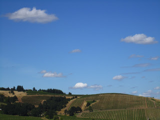
Inland: Blue skies, a scattering of cumulus humilis, ripening grapes viewed from atop a glacial erratic near McMinnville, Oregon. |
I had heard rumors about the late-summer fog pattern (thick, persistent) along the Pacific Coast beaches, but got to experience it first hand a few weeks ago in Oregon. We had picked up friends at the Portland airport on an 90+-degree day and headed southwest through the beautiful and sunny Willamette Valley (above) toward the coastal town of Neskowin.
We knew our rental house didn't have a view of the beach, so before checking in, we drove a little ways past the house to get a lay of the land. What we got was the lay of the fog (below) over every inch of ocean as far as the eye could see. Can you hear the sucking sound of the warm, inland air?
 |
| On the coast: a sunny day above, but not on, the beach at Neskowin. |
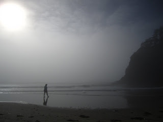
What is happening here is this: The lovely, hot, and harmless looking air we enjoyed in Portland had been rising during the day. And as the hot air rises, it creates a kind of vacuum quickly filled by the surrounding air around it at ground/sea level. As the warm air lingering over the ocean is sucked inland, it passes over the relatively cooler water and condenses. The condensed water vapor becomes visible water droplets--fog. This type of fog is called advection fog. This type of fog forms when warm, moist air is carried horizontally across a cold surface by a wind of about 6-10 mph. This gentle wind is responsible for carrying the cool air and fog to greater heights along the coast. According to the
Encyclopedia of Weather and Climate by Michael Allaby, advection fog can be 2000 feet deep.
Advection fog is "world famous" for its photogenic presence around San Francisco's Golden Gate Bridge and for making Cape Disappointment, Washington, the foggiest place in the Lower 48.
 |
| Advection fog created this lovely Coppertone-free afternoon at the beach for my friend, Mary. |
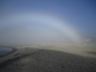
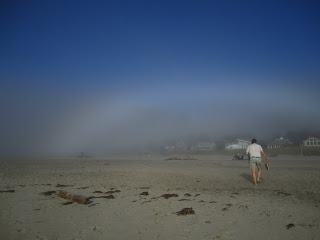
We lingered a while on the beach, watching the fog take over the beach like it owned it. It was quite a show, the highlight being my first-ever fog bow (below).
 |
| Fog bows appear as albino rainbows. |
Fog bows form under certain conditions: the water droplets in the air must be very tiny--less than .05 mm--the size of droplets of this fog. The sunlight is reflected, refracted, and diffracted by the droplets in such a way as to create white light. Larger water droplets (rain droplets) in the air separates sunlight into the classic ROY G BIV-colored rainbows.
 |
| Here my friend, Kevin, looking for the pots of white gold at the end of the fog bow. |
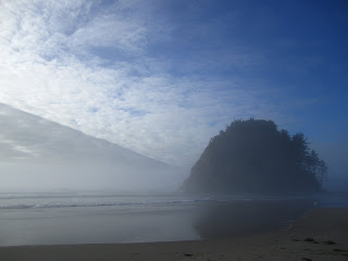
To see these fog bows, the sun has to be shining from directly behind you and into the fog. We did this for a while, then turned toward the ocean to see what appeared to be several layers of clouds moving rapidly inland. The fog was sliding in just over the water, and a thick, gray bank of clouds (I am thinking stratocumulus) were forming well offshore and condensing further into altocumulus as they floated up over the warm air, bluffs, and interior hills that rose to 1500 feet in less than 2 miles.
 |
| Proposal Rock could not steal the show from these advancing clouds. |
 |
| The clouds seem to float on a layer of invisible warm air once they encountered the land. The receding tide may have had something to do with the cloud pattern. |
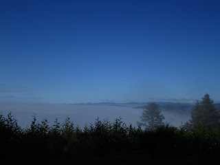
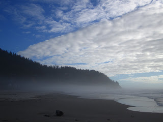
After the sun set and the inland air began to cool, there was less air moving inland and therefore, less fog blanketing our beautiful coast line (below).
 |
| This cloudscape could almost be a painting were it not for the awkwardly placed and uncroppable tree. |
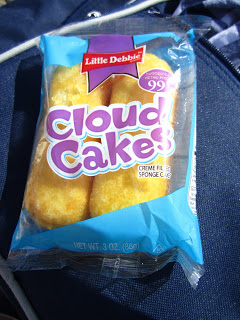
The following day was as dramatic but with more blue sky. A perfect day for a gourmet picnic featuring a dessert I knew from my East Coast childhood as "Twinkies." I probably would not have bought these at the Neskowin market had they not been renamed. They were, like the clouds and the company, as fabulous as ever.
