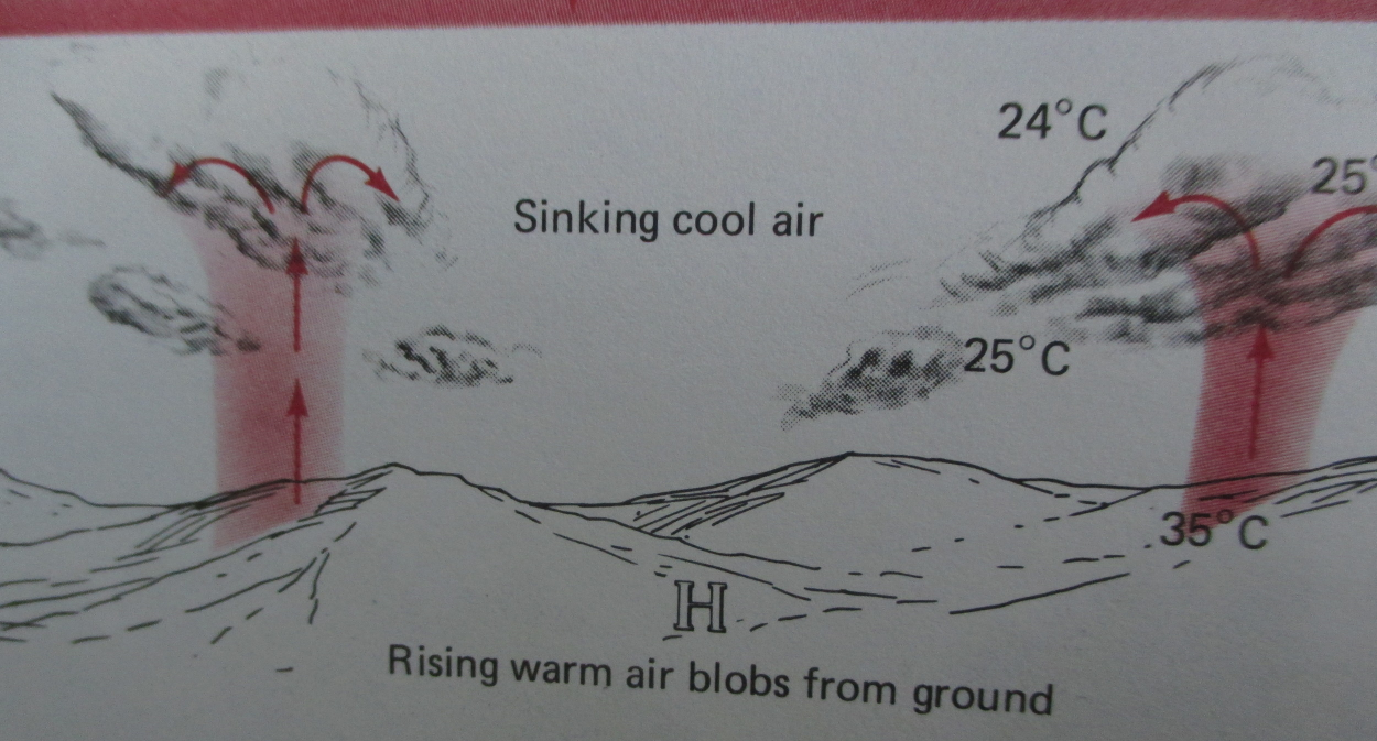
In the science and weather books I am reading, a thermal is described as a “pocket,” “bubble,” “blob,” “column,” or “parcel” of air. Two of my meteorology textbooks include illustrations of thermals and diagrams of how thermals produced clouds. I studied the illustrations carefully, read the relevant chapters on cloud formation, but when I began explaining how a warm patch of ground became a thermal, I couldn’t do it. I was not willing to write “warm air rises and develops into a thermal.”
If I can't explain how a thermal develops, I can't explain how convection works. And if I can't do that, I can't tell you how a cumulus cloud forms.
So I e-mailed my meteorologist for help. He referred me to a specialist.
The specialist is a friend of his who specializes in cloud dynamics. I wrote the specialist a long e-mail describing my "thermal problem" in great detail. I attached the photographs I had taken of the thermals in my meteorology books--the lovely, simple ones posted here.
Simple, deceptively simple. Yellow oozy magma becomes globuless or blobs that rise up from earth and become egg yolks and then mashed potatoes (above). Though described in the caption as "blobs," the illustration (below) shows thermals as straight columns rising up to form a cloud. Hmm....somethings not right here.
Within an hour, he wrote back.
“Those are awful pictures of thermals,” he began.
I was strangely relieved.
“My concept of thermals is based on the results of numerical modeling studies and flying a sailplane in them.”
“Near the ground the air is very turbulent or chaotic. But several hundred feet above the ground these turbulent eddies coalesce to form a buoyant blob of air which we call a thermal…Some thermals are more or less bubbles of buoyant air that rise and expand. Some thermals have long tails and resemble more a jet of buoyant fluid.”
I had to pause and think about this. I imagined chaotic air whirling around my bare ankles and blowing my hair blowing into my face. I imagined eddies of water swirling around boulders in a river. I thought about the rising bubbles in lava lamp and about jelly fish with long tentacles. I pushed images of tidy air “parcels” from my mind.
“…thermals are more jet-like under low wind conditions,” he continued, “and you can sit on the ground when it is almost calm and recognize the passage of a thermal overhead by a short-lived gust of wind. Sometimes thermals become rotating columns of air which we can see as dust devils or blowing leaves, etc.”
This gave me goosebumps. I had never thought of such gusts as anything but isolated, inexplicable puffs and swirls of wind. I began looking forward to experiencing my next gust, knowing it might be connected to a thermal and a potential cloud.
And then, best of all, the specialist included this image of thermals.
This shows rising heat--not so much in columns or blobs--but in more organic shapes like mountain peaks or stalactites. In this modeled image the thermals are rising up--but have not yet reached the condensation level. The might never reach it, but sink back to earth instead.
NEXT BLOG: More on how thermals form and rise to become clouds.


